


Strong high pressure aloft with low level offshore flow will
result in well above normal temperatures through midweek. Expect
more record or near record highs during this time frame. The
hottest day for most areas will be on Tuesday, when temperatures
will soar into the upper 80s to upper 90s. In other words, highs
will be about 15 to 20 degrees above normal.
The greatest health impact from the heat will be in areas that
will experience the least cooling at night. Lows are only
forecast to be in the 60s on the higher hills and in places such
as the I-5 corridor from Everett to Federal Way. Elsewhere, min
temperatures in the 50s will provide a better break from the
heat.
During hot spells, those without air conditioning, the elderly,
and those who engage in prolonged activities outdoors are more
vulnerable to heat-related illnesses. Stay hydrated and seek air
conditioned places during hot spells.
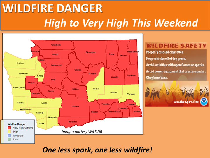
Conditions were abnormally dry due to below normal rainfall this
summer. This has resulted in a high fire danger. The grasses and
brush were quite dry, which means that they will easily catch
fire. Avoid throwing cigarette butts out of vehicles, dragging
tow chains on the ground, and parking in tall grass.
www.weather.gov/seattle
Expect more record or near record highs during this time frame. The hottest day for most areas will be on Tuesday